Quick Links: Contact Us | FAQ | See Models
Optical & SAR AI Fusion
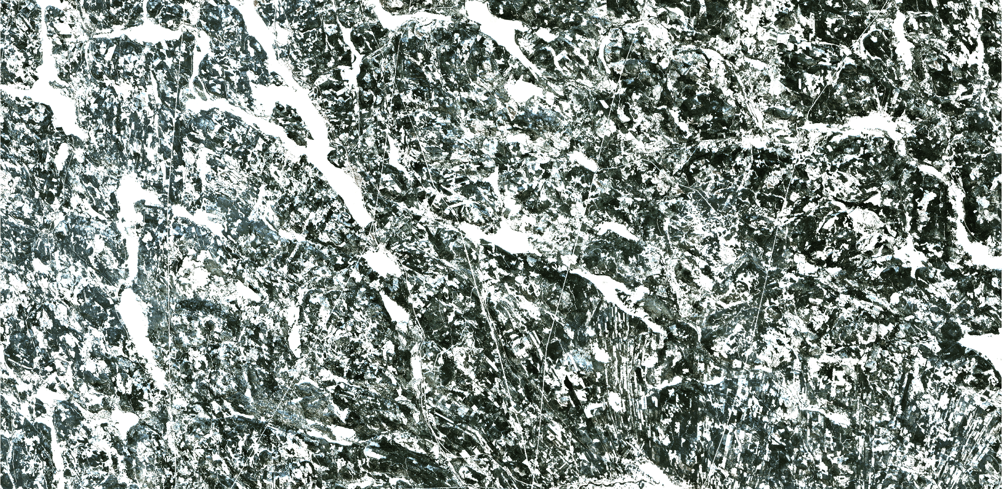
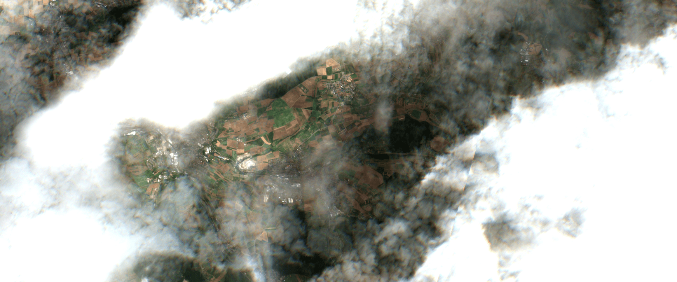
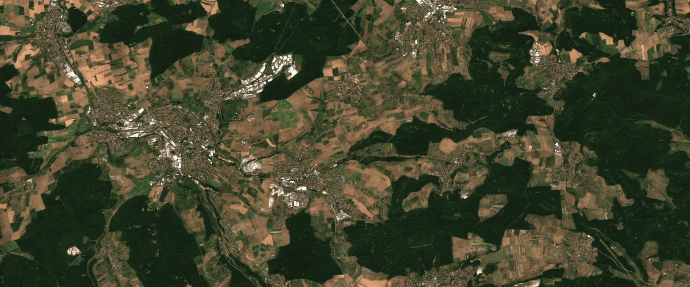
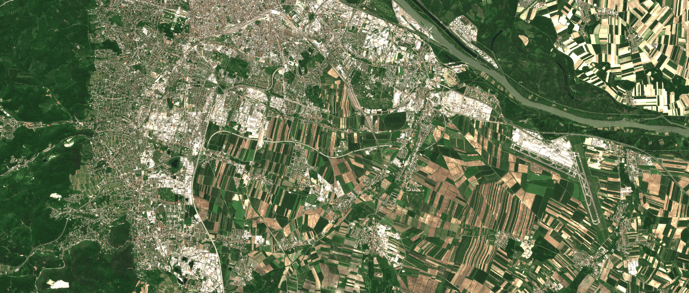
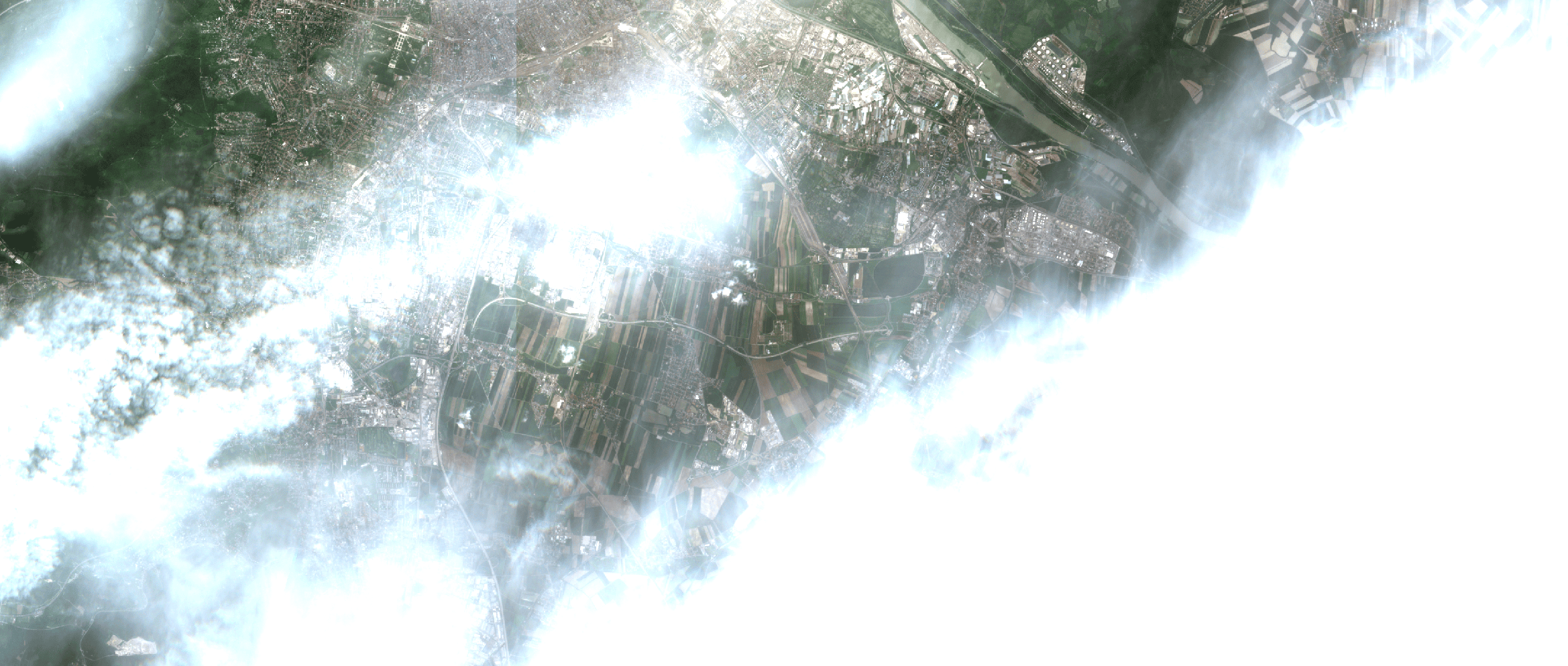
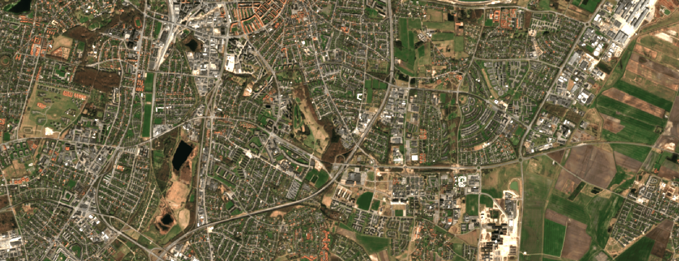
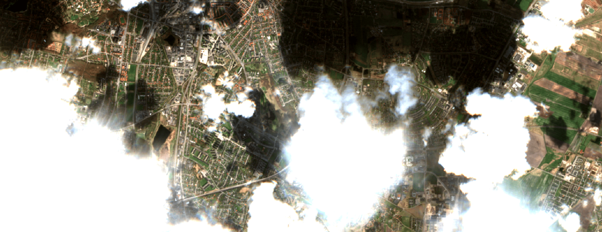
Our AI combines optical and radar (SAR) imagery to reconstruct missing Sentinel-2 data, preserving spectral integrity and enabling 100% analysis-ready, cloud-free images.
Near Real-Time Delivery
Order on-demand fused imagery with no interpolation. Get high-quality, cloud-free Sentinel-2 data processed in near real-time for seamless analysis and decision-making.
Seamless Workflow
Order tiles or custom bounding boxes to fit your exact needs, down to 1 km². Skip manual cloud masking and post-processing, and get analysis-ready data instantly.
Continuous Monitoring
Access flexible revisit speeds from daily to weekly. Our cloud-free imagery is excellent for tracking NDVI, deforestation, land cover changes, and other environmental metrics.
Data Fusion as a Service
Unlock the full potential of satellite data with AI-powered fusion. Our technology seamlessly integrates multi-sensor sources (optical and SAR) to generate cloud-free and analysis-ready imagery. Increase temporal reliability, improve consistency across datasets, and gain uninterrupted insights for monitoring and change detection.
Access ClearSKY Sample Data
Get sample datasets showcasing our cloud-free Sentinel-2 imagery. Experience the quality of our AI-processed data firsthand.
Cloud-Free Sentinel-2
Get cloud-free Sentinel-2 imagery on your schedule — whether it's daily, weekly, or anything in between! No more gaps in monitoring due to cloud cover, just uninterrupted satellite insights, tailored to your specific needs.
Why ClearSKY Vision?
Best-in-Class Cloud Removal
Instant, analysis-ready imagery with full spectral fidelity.
Global, On-Demand Coverage
Any tile, any time — no borders, no mosaics, flexible revisit rates.
Rapid Turnaround
Cloud-free imagery delivered on your schedule and on your terms.
Seamless API & Support
Plug-and-play API with rapid support and expert integration guides.
Enterprise-Grade SLA
Strong enterprise SLA with 99.8% uptime commitment.
Six Years of Experience
Leveraging six years of pioneering R&D in data fusion.
Trusted by Leading Organizations
Analysis-Ready Data
Avoid the hassle and jump straight into actionable insights with perfectly preprocessed, analysis-ready imagery. No more time-consuming cloud masking or calibration. Save on costly data preparation and enjoy the freedom to focus on what matters most: informed decisions.
Near Real-Time Insights
Our near real-time data fusion works across all applications. At ClearSKY Vision, we merge only current and past sensor inputs, avoiding any use of future data or model-based interpolation, so today’s imagery reflects genuine conditions and is ready for immediate analysis.
Seamless Integration
Drop ClearSKY’s cloud-free satellite imagery straight into your GIS, dashboards, or models. Whether you’re tracking crop vitality with NDVI, monitoring logging activity with BSI, or running bespoke multispectral analytics, our AI-driven pipeline delivers analysis-ready pixels that slot effortlessly into your existing workflow. Explore the API today.